Merry Christmas


Hey guys Merry Christmas I just want you to know that Walk Riverside will return after Christmas. Don’t panic part 4 is on it’s way, I just needed a break from all to focus on the festivities. Here in New York it’s been extremely warm and wet but we are still in a precipitation deficit so every little bit helps. Nonetheless, as the movie Elf says “The best way to spread Christmas cheer is singing loud for all to hear,” well not too loud. So here a song that reminds us that Christmas isn’t always perfect and then it all comes together. I will put up pictures soon!

Confession I’m a sucker for songs with Saxophones.

Merry Christmas


-AJS

Walking Riverside Drive part 3: The Riverside Delta, Audubon Park, and Riverbank State Park.

Part 3 in a series Part 1 and Part 2 found here.

Okay week three and finally no more highways! Well it’s still below me but for a few blocks I had some peace and quiet. In fact, I was probably the noisiest person on the block. So picking up where I left off I returned to the site where Riverside Drive merges with Riverside Drive West. As I walked on the drive the road rose to go along the side of the hill that the apartment buildings sit on to the right. Most of the pre-war buildings had nice decorative works. A bit on the simple side but bear in mind these apartments were often more spacious than the tenements in Lower Manhattan or down the hill in Harlem for that matter.

P1070522

Gothic styled entrance at 909 Riverside Drive

The lower section still has older row houses that survived the rapid development in the 1910’s-1920’s. This was helped by the opening of the subway’s first extension in 1906. The apartments appear spacious and thanks to the funky property lots, it allows better light and air into the apartments.

P1070549

Row houses on the lower section Riverside Drive f.k.a Boulevard Lafayette

P1070533

Tenement Rows on W. 160th Street.

The upper half of the delta is the long-lost Boulevard Lafayette. The road first appeared in maps dating back to the mid 1800’s. It appears to be an offshoot of Broadway, which at the time the upper section was simply called Boulevard. Around the time Riverside Drive was being proposed it was supposed to terminate at the intersection of 158th and Boulevard Lafayette. How the Grinnell family was able to smooth out the angles is anyone’s guess but I like to think that if they proposed Riverside Drive as a form of improved transportation to the area if any way then it would make the area more desirable. This was accomplished by building the viaducts across Harlem to Audubon Park.

Audubon Park as you can see there were already thinking about Riverside Drive map by the Grinnell family.

The intersection does have one cling to fame. It is referenced in F. Scott Fitzgerald’s classic novel, The Great Gatsby, where Tom, Nick and Tom’s girlfriend Myrtle Wilson have a party inside Tom and Myrtle’s love nest. While Nick describes the apartment building as “one slice in a long white cake of apartment houses,” for some reason I like to think it’s the Grinnell since they did elevator operators. Also, Fitzgerald was in Paris when he wrote the book so he used his imagination.

P1070590

The Grinnell from 158th and Riverside, possibly a location in The Great Gatsby.

Another major development in the neighborhood is Audubon Terrace, which was formerly home to institutions such as the National Museum of the American Indian, American Geographical Society, and the American Numismatic Society. The beautiful complex of Beaux-Arts and American Renaissance architecture was the brainchild of the Huntington family, in particular Archer M. Huntington.

P1070581

Audubon Terrace at night

Huntington thought, like most traditionalists of his era that the city’s wealthiest residents would move uptown to today’s Washington Heights. With its commanding views of the area it’s hard not to imagine the upper crust sitting on top. However, with the advent of steel construction, which made building apartments cheaper and faster, developers looked up north to grab what land they could.  The subway also made commuting to lower Manhattan easier, thus attracting more middle class residents not the moneyed or cultured kind that the Huntington’s wanted.

P1070594

El Cid the centerpiece of Audubon Terrace sculpture by Anna H. Huntington

Nevertheless, the Huntington’s pressed on, creating or backing institutions that would eventually move uptown to Audubon Terrace. It took nearly three decades to complete the terrace as we see it today. However, it was in the 1930’s, which saw multiple ethnic groups, each having very little to do with the ideals of the institutions that resided there, left them behind. At the same time Audubon Terrace, also turning in on itself, became as the New York Times wrote in 2009, “Upper Manhattan’s lovely but bedraggled cultural acropolis.”

That’s not to say that the Terrace is dead. Boricua College, a bi-lingual college that prides itself on being a non-traditional college, moved into the old Geographical Society building, and the two remaining institutions, the Hispanic Society of America and the American Academy of Arts and Letters have expanded into buildings formerly owned by their neighbors. With a little luck and some more exposure both within the community and the city at large, Audubon Terrace will regain its place in the city’s cultural offerings.

Heading further south I saw this beautiful sculpture called “The Shipwreck.” Which was created from a highway arts program. It faces towards the Hudson River with the bow of the ship facing skyward to show it sinking below the waves or rather into the concrete.

P1070607

Shipwreck

As I walked further down, you pass the ominous Trinity Cemetery which looks like your classical creepy neighborhood cemetery, this time of the year. Despite being in Manhattan, it still has space for burials and cremations but space is limited and expensive so do what the living does, move to Brooklyn. Famous people buried there include former mayor Edward I. Koch and writer Ralph Ellison

P1070613

Trinity Cemetery I wonder who’s the man on the column?

By now the apartments are beginning to look a bit shabby, due to years of neglect but some are seeing the return to their glory days like 730 Riverside Drive. 730 Riverside Drive or the Beaumont, was the home of author Ralph Ellison, whose book Invisible Man still resonates today as it did when it was published decades ago. In recent years a small yet no less profound monument dedicated to Ellison and the book that defined him grace a garden just steps from his apartment.  The parks department website describes the purpose of sculpture which captures “the themes of Ellison’s novel whose central protagonist wrestles with issues of racial identity.”

P1070622

730 Riverside Drive

P1070624

The Invisible Man monument to Ellison and his novel sculpture by  Elizabeth Catlett


Diagonally across from Ellison’s memorial, is a playground that has two sets of steps leading down to the park and over a set of railway tracks that lead to Penn Station. According to maps, there was once a train station in the vicinity so the bridge was likely added to give passengers access to the station. However, passenger service on the line ended around 1916 only to resume in the 1990’s but without restored stations. A station here might make sense with nearby Riverbank State Park benefiting from better access and in the event of a subway shutdown, it provides an alternate route.

P1070628

Bridge and stairway to the overlook

P1070627

Tracks to upstate New York and the George Washington Bridge

P1070614

The George Washington Bridge under a gloomy grey sky

Speaking of Riverbank State Park, it should be noted that the occasional whiffs of sewage being treated can still occur so I’d advise anyone following in my footsteps to have a full meal and bring water. You might run the risk of dizziness and nausea.

Riverbank State Park is also a classic example of local environmental justice. It took three decades to complete the park after years of protests and delays with the project. The waste-water treatment plant which is underneath the park cost $1.3 Billion dollars. It was according to the blog Place Matters, “it was the largest non-military public works project in the US in 50 years.” However, almost immediately the smell, which was not taken into account exacerbated existing air pollution issues since there is an MTA bus depot and the Henry Hudson Parkway nearby. While the park has been successful in drawing not just local residents but other Manhattanites, that smell and other environmental still lingers from time to time.

P1070631

The ominous stacks on top of Riverbank State Park.

Getting back to Riverside Drive from the brief detour, one begins to notice the change in elevation as Broadway is higher up while Riverside Drive is lower, also traffic segregation occurs allowing drivers to speed uptown to George Washington Bridge. In the case of 138th Street, it actually dives down underneath the drive to become 12th Avenue. Case in point


P1070726

138th Street as it dives under Riverside Drive to become 12th Avenue


The only street that meets Riverside Drive on the same level is 135th Street. Which is where I’m going to end part 3 on one of the rarest blocks in Manhattan. The reason being is that it reminds me of old city photos which showed rows and rows of apartment buildings but without trees it’s a throwback to when trees were not consider part of the streetscape in some neighborhoods particularly poorer and working class ones.  The neighborhood, once filled with Irish, German and Jewish residents are now filed with migrants from Latin America. Today, we acknowledge that trees help neighborhoods maintain some ecological footprint but for the current residents, the greenery gives them a reminder of home.

P1070727

Looking West on 135th Street to New Jersey still evokes a New York of generations past.


So now I’m just about halfway finished with the project but things are going to change once we cross the Riverside Drive viaduct, for we are now entering Riverside Drive’s classical period.

Walking Riverside Drive Part 2: Under the bridge, around a hospital and over 158th street!

This is part two in a series on Riverside Drive. For part one click the link To catch up.  

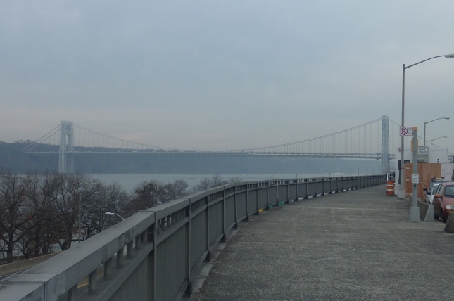
Hey everyone! Thanks for the feedback and joining me on this project. This will be part two of the project Here we’ll pick up where I left off which was Plaza Lafayette, a small park with a gorgeous view of the George Washington Bridge. One of only three bridges that connects New York City with the state of New Jersey. In fact, the original bridge was actually placed further downtown but opposition by local residents and businesses forced the project uptown. However, their loss was uptown’s gain. Not only did the bridge spur development like Riverside Drive did just a few years prior, it also opened the city of Fort Lee New Jersey, to developers as well.

P1070303

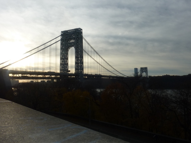
George Washington Bridge under cloud cover

The bridge was designed by architect Othmar Ammann, who also designed the Triborough Bridge and the Verazano-Narrows Bridge, won the project out from his own mentor and boss, Gustav Lindenthal. Sadly, this opened a feud between the two architects during the construction of the bridge and likely did not get resolved. Nonetheless, the project was completed in 1931, six months early and under budget. It is one of the most photographed bridges in the world.

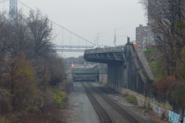
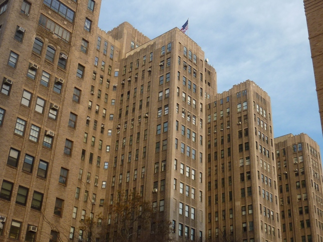
As I walked down from Plaza Lafayette, I descended under the arched approach of the bridge and was struck at the view of the skyscrapers that I could still see from this vantage point. The sidewalk continues down the hill to the bottom where Riverside Drive once again joins the Henry Hudson Parkway. Rather than risk going through open traffic, pedestrians can return to Washington Heights via a series of ramps. The ramps however are under a highway interchange between the parkway, the bridge and local streets so while you’re driving you might see the bridge and New Jersey I was in an area that after dark I myself didn’t want to be caught dead in. Nevertheless, I made my way up for air and once again was greeted by the bridge.

P1070309

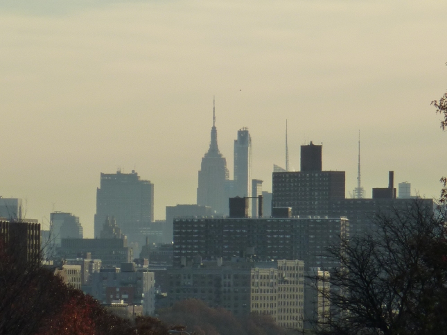
Empire State Building from under the Arch approach to the George Washington Bridge

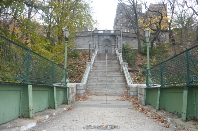
On another note that interchange claimed one victim.  Before the bridge was opened local residents had access to the park below by a series of stairwells that gave the park a European feel. Sadly the highway interchange blocked the original access point and its replacement, while possibly more ADA compliant is an uninspiring afterthought. Placed in second to the needs of the cars that whizz by. I could have explored the lost stairwell further but something told me some things are best left alone. Especially if you yourself are alone.
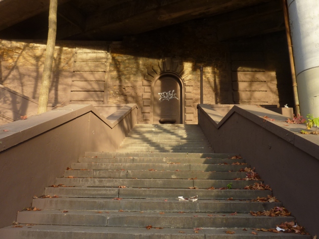
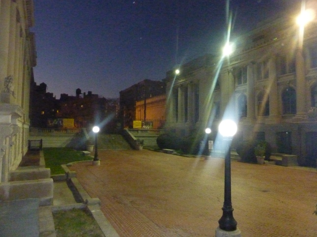
P1070319

Stairway to nowhere

Haven Avenue is a short nine block street that is not in a straight line. An extension of Riverside Drive perhaps? Well I’ll never know but I can tell you that the street on a Friday afternoon is very quiet. So quiet and so New York in its way that I’m not surprised filming doesn’t take place here on a regular basis. The street is book-ended by both the George Washington Bridge and New York-Presbyterian Hospital complex, giving the street its calm and intimate setting.

The street has mostly Art-Deco and Beaux Arts inspired buildings along its brief run, only punctuated by two modernist apartment buildings and what could only described as a futuristic at best and painfully out of place at worst. 98 Haven Avenue, being built for Columbia University Medical Center’s new Medical and Graduate Education Building, strikes me as a something that belongs downtown say near the Hudson Yards and spoils the uniformity of the street. “The New York Observer” called it “the craziest building in Harlem,” as their title to their article about the structure in 2012.

Side Note: By stating it’s in Harlem and not Washington Heights, it just adds salt to the wound. Then again I’m not surprised, the Observer always struck me as the stereotypical downtowner publication. To them, Harlem and Washington Heights are places to be colonized and homogenized not to be respected in their place in New York’s history. Not to mention the mislabeling is really bloody lazy. I’ve lived in both ‘hoods and believe me when I say this, they are distinctive as they get.

P1070326

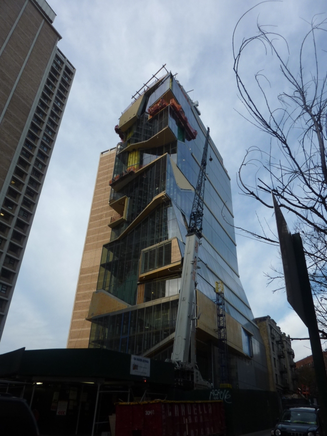
The future has come to Washington Heights

Hopping off the soap-box, and shaking my head over that crazy building, I walked along the gargantuan complex of building that make up the New York-Presbyterian/Columbia University Medical Center. The first buildings opened in 1925 and the hospital has been growing ever since. In fact within 30 years of the hospital’s existence over 100,000 babies were born there. While the complex has modernized over the years the Hospital still retains both a garden and a chapel, a welcome respite from the frenetic pace inside.

P1070330

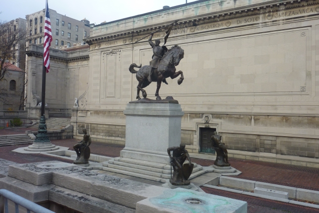
The back-end of the original hospital buildings

Turing onto 165th street, I once again returned to Riverside Drive and was greeted by yet another view of the George Washington Bridge. Nearby was a viewing platform so that joggers and dog walkers can take a break and marvel at one of the country’s greatest creation.

Now heading south again, I was face with another dilemma, I had now two paths to choose from when it comes to Riverside Drive. Due to the Grinnell family, who had been pushing development in the area during the late 1800’s they convinced the city to run Riverside Drive through the property once owned by the neighborhoods namesake John James Audubon. The route change creates the letter D or a Delta shape on the city’s grid. So now I had to choose which side of the D to walk on.

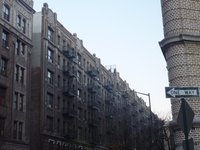
Should I hug the river and see what was next or turn left and admire some more apartment buildings? Realizing that time was getting short, I figured that the river was my best bet. So I walked the so-called Riverside Drive West. As the sun was setting the so-called golden hour illuminated the brick and mortar buildings with a radiance that could make an old and tired building look new, if only for a few minutes.

P1070375

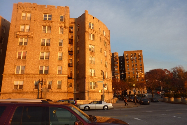
Apartment building under that golden hour glow

I was now walking along the second Riverside Drive viaduct, built in 1911 it’s less popular than its Harlem cousin but in my opinion it has a dramatic flair that the other viaduct, striking in its own right, can’t claim. For one, you can still see the Empire State Building from here. The steps that lead to the park below still exist but the highway demolished much of the original park. The park today still serves its residents well despite the Robert Moses gash of a highway nearby.

The sweeping views were so inspiring in the musical department, I threw on Whitney Huston’s “Saving All My Love For You,” because it reminded so much of the music video.  Whitney is walking down The Queen’s Walk, in London realizing that she’s not going to be with her boyfriend who is married by the way. Yet, that sax solo brings me back every time. Today the London Eye sits on that site of 80’s nostalgia.

P1070368

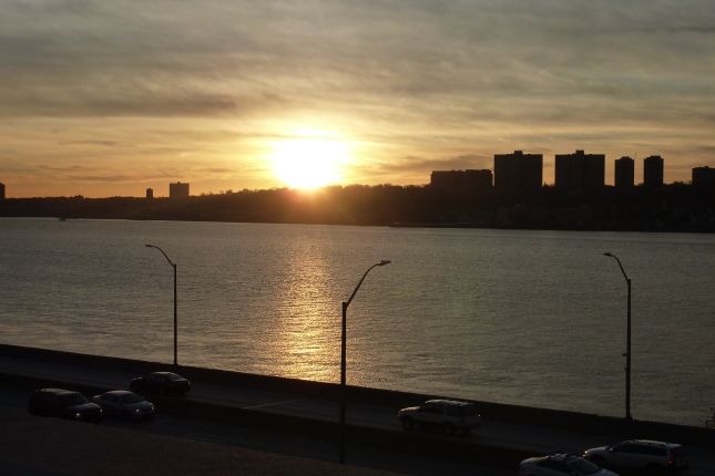
Sunset over in New Jersey

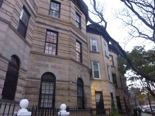
So now I’ve made it to the bottom of the viaduct and decided to walk back onto the original Riverside Drive. Almost immediately, I was struck by how beautiful the buildings were. Tucked away from bustle of Broadway and the wide expanse of the viaduct, the buildings were built during the early 20th century when the subway arrived in the neighborhood. At the time these buildings were the cream of the crop housing some wealthy or newly wealthy residents.  Today the buildings are now part of the Audubon Park Historic, designated in 2009.

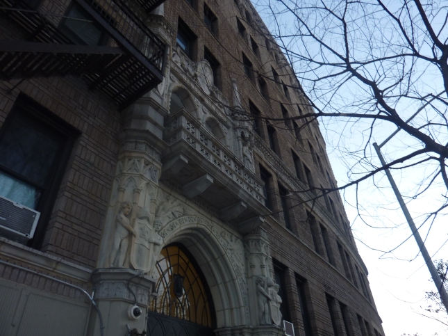
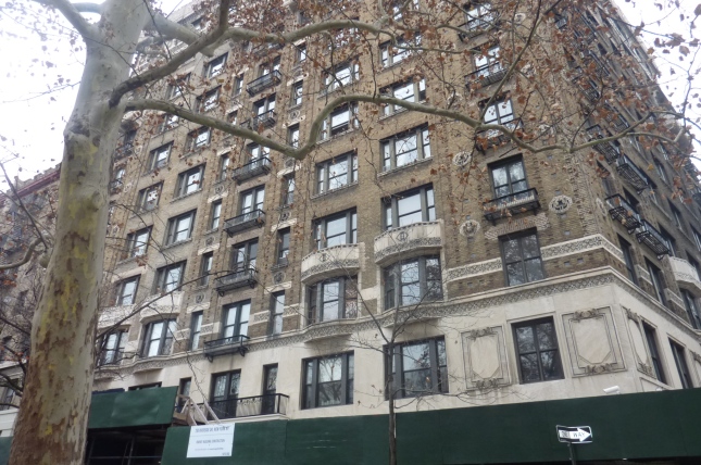
One building that sticks out is the Grinnell, sitting on a plot of land that was once owned by the family of the same name, the building, built in 1911, commands your attention. According to the website, Audubonparkny.com, which has an extensive history of the micro-neighborhood, the Grinnell was built at a cost of $600,000. Today that would be somewhere between 14 and 15 million dollars. For the first few decades this is what buying an apartment at the time would get you, amenities wise.

P1070384

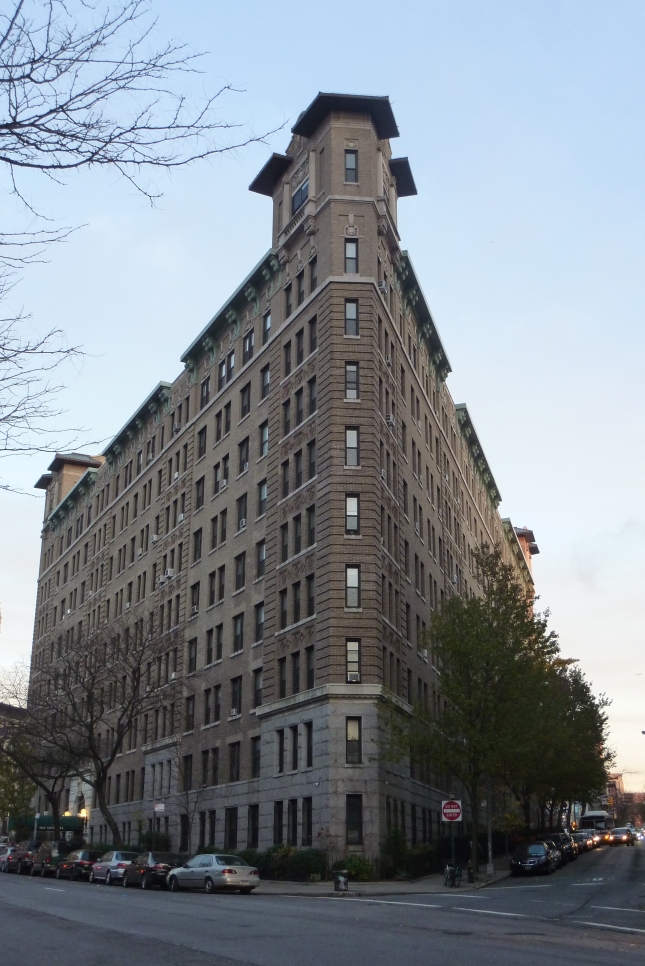
The Grinnell, refered to as “the Dakota of the North” this building is the grand dame of neighborhood.

“The Grinnell had uniformed staff, twenty-four hour elevator service, and mail delivery to apartment doors – twice a day.  Every apartment had a dumbwaiter so that deliveries could be made through the rear entrance and basement.  The dumbwaiters also served to transport rubbish and soiled clothes to the basement, which contained a building-operated laundry.  Until recently, large drying racks remained as a reminder of those days.  Stories passed on by early residents report that the Grinnell’s management gave dances for the residents every spring – on the roof, with a full orchestra.”  

Sounds like a great time, well the cost of an apartment there ranges according to the realtor Streeteasy.com about just over $600,000 to a cool $1,000,000. Cheaper than the Upper West Side but pretty expensive for uptowners like me.

So guys I’m gonna leave it here I will do the rest of the crazy D. Delve into its history and keep on walking!